ePrivacy and GPDR Cookie Consent management by TermsFeed Privacy Policy and Consent Generator PR TF 57 Callejón de Teno

PR TF 57 Callejón de Teno

PR-TF 57

Macizo de Teno

Difficulty: Medium

Description

The Callejón de Teno trail is an old camino real (“royal road” or main island route) that used to link El Palmar and Teno Alto.

The route starts at the Los Pedregales Visitor Centre, from where it heads uphill along the cobbled path towards the Teno Massif to the west.  

From the Alto de la Cumbre viewpoint you will enjoy magnificent panoramic views of the El Palmar Valley, the Los Corchos ravine and, in general, the beautiful Teno Rural Park. 

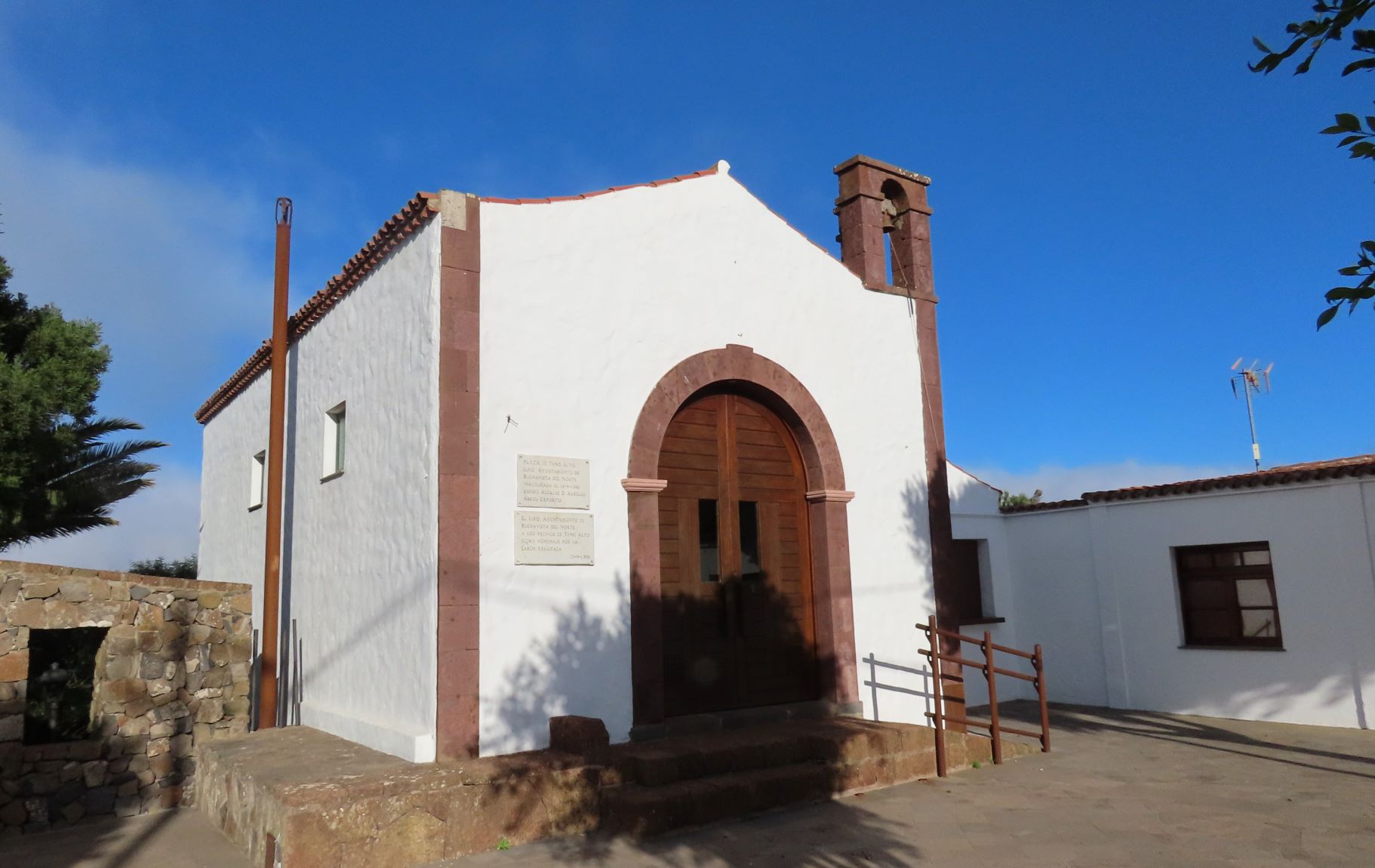
Then take the Pista de Los Lavaderos track to descend to El Bailadero, and finally on to the church of Teno Alto, the end point of the route.

Tips

  • Always stay on the marked trail and do not enter private property, hunting grounds, water galleries, wells or caves.
  • Pay special attention when crossing or walking along trails used by bicycles, horses or motor vehicles and when walking in ravines with water courses.
  • Avoid direct encounters with potentially dangerous animals, such as livestock, beehives, and dogs.
  • Proceed with caution and watch for obstacles, loose rocks, uneven terrain or steep slopes to avoid accidents and falls.
  • Check out our guide to hiking in Tenerife and, if necessary, contact the emergency services by calling 112.


Recommendations and tips

Guides

No data available

Permits

  • Application form must be submitted by public or private non-profit entities (schools, associations, sports clubs, etc.). Please email This email address is being protected from spambots. You need JavaScript enabled to view it..
  • Authorisation required for public or private for-profit entities, via this link
  • Free access for all other visitors, no reservation required.
More information

Technical information sheet

Route information

Walking route

Tenerife ON

Linear

3,87 km

1 h 55 m *

452,85 m

212,16 m

* TPL_GESPLAN_FITNESS_OBSERVATIONS

  • Altitude gain:452,85 m

  • Altitude loss:212,16 m

  • Maximum altitude:830,43 m

  • Minimum altitude:530,36 m

Signage

Route code

PR-TF 57

Posts and signs displaying the PR code and yellow and white marks.

Signage

Route map and profile

Elevation profile

Difficulty

Medium *MIDE safe mountain criteria

  • Maximum altitude:830,43 m

  • Minimum altitude:530,36 m

Connections with other routes

How to get to route start point

Los Pedregales Visitor Centre, Teno Rural Park, Carretera Buenavista (TF-436), km 6.

Bus numbers 355, 365 and 366, Las Canales bus stop code 4546. TITSA

Parking spaces available in the village.

How to get to route end point

Plaza de Teno Alto, Camino Los Bailaderos, Teno Alto.

No nearby service.

Limited parking spaces available in the village.

Municipalities passed through

  • Buenavista del Norte

Protected Areas

Transit

Parque Rural de Teno

Teno Rural Park is located in north-west Tenerife, in one of the first parts of the island to emerge from the sea, containing materials that are between 6 and 7 million years old.  Erosion has ...

Discover the Protected Area
Parque Rural de Teno

Weather

Today, tuesday, in Buenavista del Norte


Clear skies
Wind

4 km/h

Temperature

18ºC Maximum

15ºC Minimum

Rain

111%

3 day forecast

wednesday

17ºC Maximum

15ºC Minimum

thursday

18ºC Maximum

16ºC Minimum

friday

17ºC Maximum

16ºC Minimum

Places of interest

These are some of the points of interest you can find along this route..

Mercadillo del Agricultor El Palmar
EN Construcción singular

El Palmar Farmers’ Market

Local farm, handicraft and organic products for sale.

...
EN Construcción singular

Teno Alto Chapel

Small chapel in front of the village square, amongst farmed terraces and pastures.

...
Teno_Alto
Caserío

Los Bailaderos o Teno Alto

Reducto de las costumbres rurales de la isla, en pleno corazón del Parque Rural de Teno. Tiene...