ePrivacy and GPDR Cookie Consent management by TermsFeed Privacy Policy and Consent Generator PR TF 53 Cuevas Negras

PR TF 53 Cuevas Negras

PR-TF 53

Macizo de Teno

Difficulty: Medium

Description

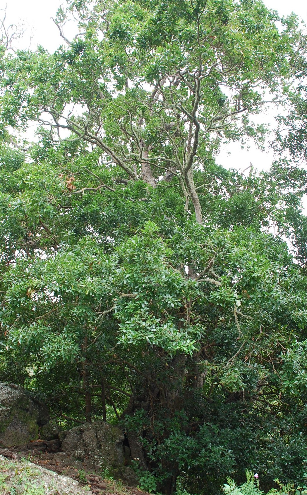
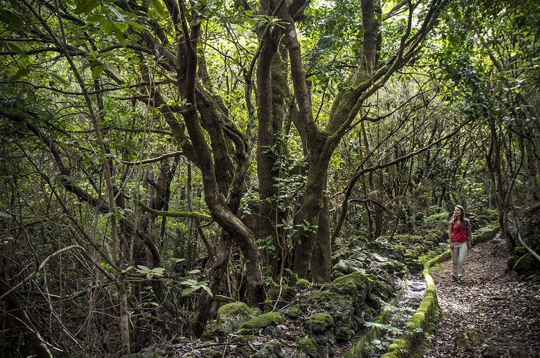
This trail starts at Erjos and heads into the dense and characteristic laurisilva forest of Monte del Agua. 

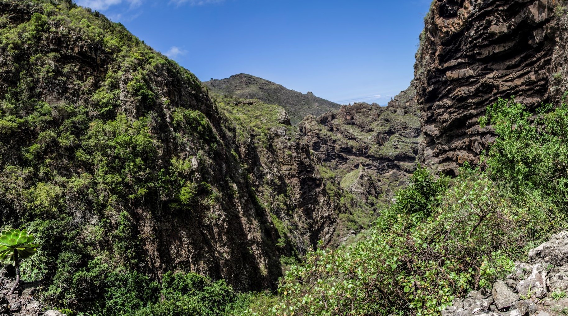
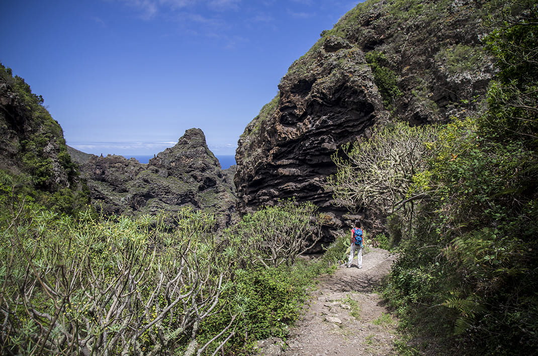
The path descends gently northwards along the course of the Barranco de Cuevas Negras ravine along an ancient camino real (“royal road” or main island route) that connected the villages of Los Silos and Santiago del Teide. If you pay close attention, you will still be able to see the cobblestones in some sections of the track. 

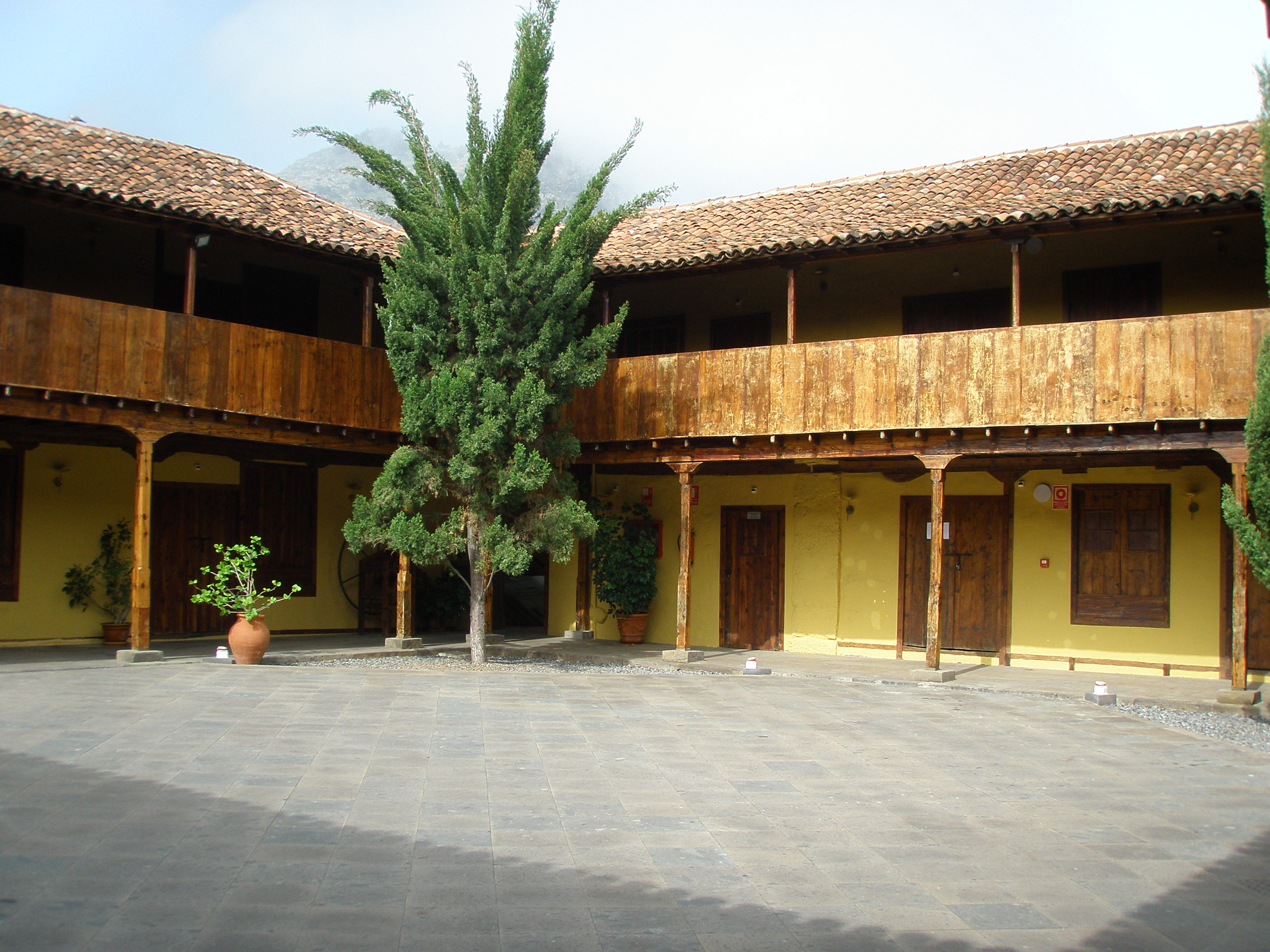
Continuing your descent through the greenery, you will come across Cuevas Negras, an example of rural Canarian architecture, and other renovated buildings. 

At this point the vegetation clears and you will be able to enjoy the views of Roque de Las Moradas. 

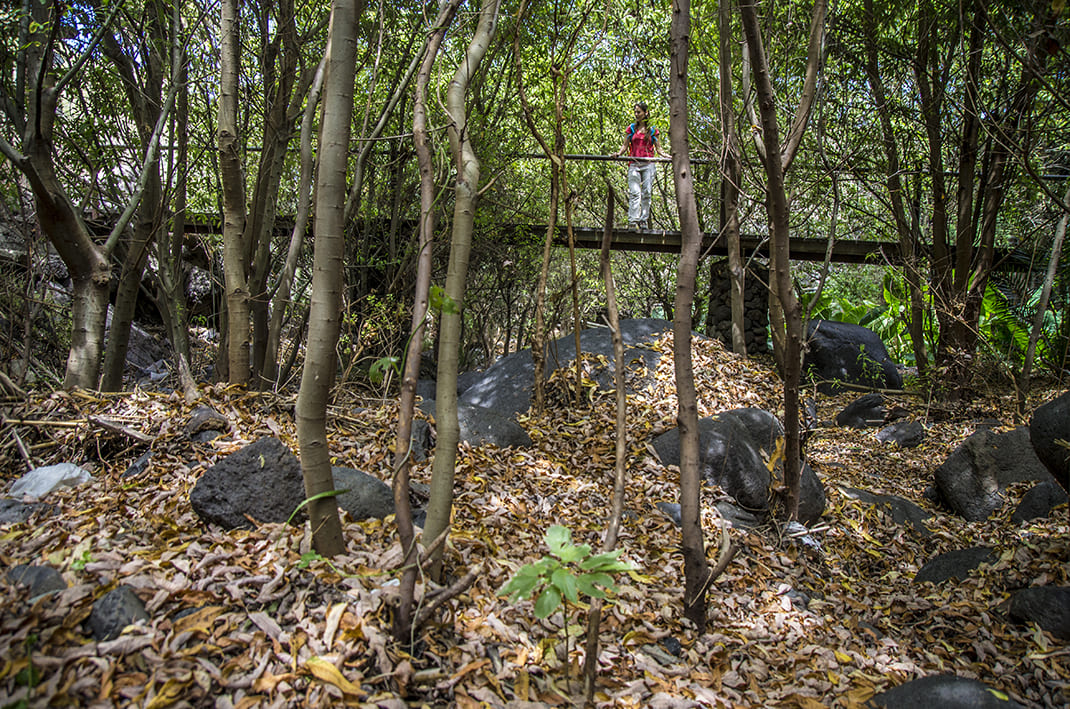
Shortly before reaching your destination you will cross two wooden bridges surrounded by water that will take you to Los Lavaderos on Calle Susana and end at the Los Silos church square, the end point of the trail.

Tips

  • Always stay on the marked trail and do not enter private property, hunting grounds, water galleries, wells or caves.
  • Pay special attention when crossing or walking along trails used by bicycles, horses or motor vehicles and when walking in ravines with water courses.
  • Avoid direct encounters with potentially dangerous animals, such as livestock, beehives, and dogs.
  • Proceed with caution and watch for obstacles, loose rocks, uneven terrain or steep slopes to avoid accidents and falls.
  • Check out our guide to hiking in Tenerife and, if necessary, contact the emergency services by calling 112.


Recommendations and tips

Guides

No data available

Permits

  • Application form must be submitted by public or private non-profit entities (schools, associations, sports clubs, etc.). Please email This email address is being protected from spambots. You need JavaScript enabled to view it..
  • Authorisation required for public or private for-profit entities, via this link
  • Free access for all other visitors, no reservation required.
More information

Technical information sheet

Route information

Walking route

Tenerife ON

Linear

5,24 km

3 h 10 m *

181,39 m

1.073,71 m

* TPL_GESPLAN_FITNESS_OBSERVATIONS

  • Altitude gain:181,39 m

  • Altitude loss:1.073,71 m

  • Maximum altitude:999,92 m

  • Minimum altitude:104,95 m

Signage

Route code

PR-TF 53

Posts and signs displaying the PR code and yellow and white marks.

Signage

Route map and profile

Elevation profile

Difficulty

Medium *MIDE safe mountain criteria

  • Maximum altitude:999,92 m

  • Minimum altitude:104,95 m

Connections with other routes

How to get to route start point

Ermita Nuestra Señora de la Sagrada Familia, Calle La Unión, Erjos.

Bus numbers 325, 392 and 460, Erjos bus stop code 4668. TITSA

Parking spaces available in the village.

How to get to route end point

Plaza de la Iglesia, Calle Susana, Los Silos.

Bus number 363, Los Silos bus stop code 4453. TITSA

Parking spaces available in the village.

Municipalities passed through

  • El Tanque
  • Los Silos

Protected Areas

Transit

Parque Rural de Teno

Teno Rural Park is located in north-west Tenerife, in one of the first parts of the island to emerge from the sea, containing materials that are between 6 and 7 million years old.  Erosion has ...

Discover the Protected Area
Parque Rural de Teno

Weather

Today, tuesday, in Los Silos


Clear skies
Wind

7 km/h

Temperature

14ºC Maximum

6ºC Minimum

Rain

0%

3 day forecast

wednesday

16ºC Maximum

6ºC Minimum

thursday

16ºC Maximum

8ºC Minimum

friday

15ºC Maximum

9ºC Minimum

Places of interest

These are some of the points of interest you can find along this route..

Conjunto_Historico_Los_Silos
EN BIC

Los Silos Conservation Area - BIC (Asset of Cultural Interest) Conjunto histórico (Conservation Area)

The agricultural past of Los Silos is extremely evident throughout the history of the...

Tenerife ON
EN Caserío

Erjos

Village located 14 kilometres from the centre of Los Silos. Given over mainly to agriculture and...

Nuestra_Senora_Luz
Construcción singular

Iglesia Parroquial de Nuestra Señora de la Luz

Primer edificio religioso que se construyó en Guía de Isora, en el siglo XVI. Consta de tres...

Plaza_Luz_Silos
Construcción singular

Mercadillo del Agricultor de Los Silos

Variedad de frutas y verduras, especias, dulces y pasteles, quesos y vino.

...
Tenerife ON
EN Lavadero y fuente

Lavaderos de Susana

This old wash-house is an iconic place where peace reigns, ideal for relaxation, and an important...

Barracno_Cuevas_Negras
EN Barranco

Barranco Cuevas Negras / Barranco del Agua

Ravine that links the town of Los Silos with Monte del Agua, home to the abandoned hamlet of...

Barbusano Cuevas Negras
EN Árbol monunental

Barbusano (Canary laurel tree) Cuevas Negras

Grows on the basalt wall of the ravine with many suckers sprouting from its base. A landmark for...

Antiguo_Convento_Franciscano_Los_Silos
EN BIC

Former San Bernardo Convent - BIC (Asset of Cultural Interest) Monument

The convent of San Bernardo was founded on 31 August 1649 by Captain Sebastián Pérez Enríquez...

Convento_Los_Silos
EN Punto de información turística

Los Silos Tourist Information Office.

Los Silos Tourist Information Office.

...
Lavadero y fuente

Lavaderos de Cuevas Negras

Lavaderos en el Caserío de Cuevas Negras, característico de la cultura rural popular...