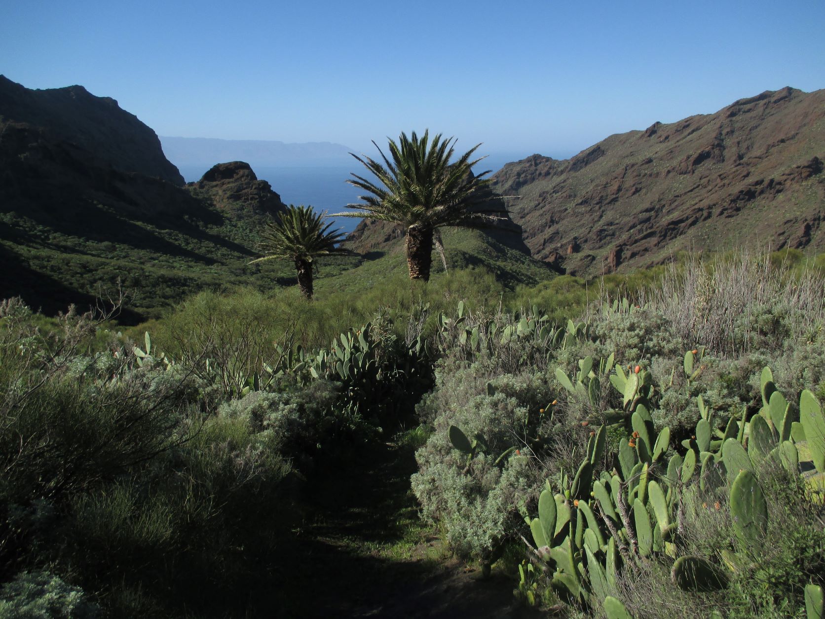
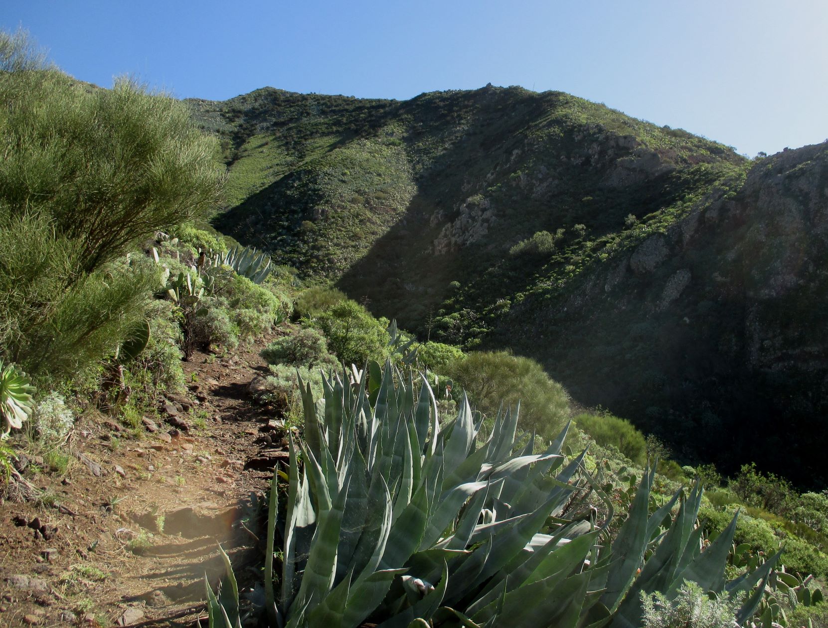
ePrivacy and GPDR Cookie Consent management by TermsFeed Privacy Policy and Consent Generator PR TF 51.1 Los Carrizales

PR TF 51.1 Los Carrizales

PR-TF 51.1

Macizo de Teno

Difficulty: Medium

Description

Extension of the PR TF 51 trail from San José de los Llanos to Punta de Teno, which takes you to the hamlet of Los Carrizales, next to the ravine of the same name (Barranco del Carrizal).

Tips

  • Always stay on the marked trail and do not enter private property, hunting grounds, water galleries, wells or caves. 
  • Pay special attention when crossing or walking along trails used by bicycles, horses or motor vehicles and when walking in ravines with water courses.
  • Avoid direct encounters with potentially dangerous animals, such as livestock, beehives, and dogs.
  • Proceed with caution and watch for obstacles, loose rocks, uneven terrain or steep slopes to avoid accidents and falls.
  • Check out our guide to hiking in Tenerife and, if necessary, contact the emergency services by calling 112.


Recommendations and tips

Guides

No data available

Permits

  • Application form must be submitted by public or private non-profit entities (schools, associations, sports clubs, etc.). Please email This email address is being protected from spambots. You need JavaScript enabled to view it..
  • Authorisation required for public or private for-profit entities, via this link
  • Free access for all other visitors, no reservation required.
More information

Technical information sheet

Route information

Walking route

Tenerife ON

Linear

2,08 km

1 h 10 m *

518,07 m

51,27 m

* TPL_GESPLAN_FITNESS_OBSERVATIONS

  • Altitude gain:518,07 m

  • Altitude loss:51,27 m

  • Maximum altitude:885,85 m

  • Minimum altitude:419,05 m

Signage

Route code

PR-TF 51.1

Posts and signs displaying the PR code and yellow and white marks.

Signage

Route map and profile

Elevation profile

Difficulty

Medium *MIDE safe mountain criteria

  • Maximum altitude:885,85 m

  • Minimum altitude:419,05 m

Connections with other routes

How to get to route start point

PR-TF 51 (San José de los Llanos - Punta de Teno).

Trailhead accessible only on foot from PR TF 51 (San José de los Llanos - Punta de Teno).

Trailhead accessible only on foot from PR TF 51 (San José de los Llanos - Punta de Teno).

How to get to route end point

Calle Carrizal Bajo, 10, Buenavista del Norte.

Bus numbers 355 and 365 are located 500 m from the end of the trail, El Carrizal bus stop code 4551. TITSA

Parking spaces available in the village.

Municipalities passed through

  • Buenavista del Norte

Protected Areas

Transit

Parque Rural de Teno

Teno Rural Park is located in north-west Tenerife, in one of the first parts of the island to emerge from the sea, containing materials that are between 6 and 7 million years old.  Erosion has ...

Discover the Protected Area
Parque Rural de Teno

Weather

Today, tuesday, in Buenavista del Norte


Clear skies
Wind

4 km/h

Temperature

18ºC Maximum

15ºC Minimum

Rain

111%

3 day forecast

wednesday

17ºC Maximum

15ºC Minimum

thursday

18ºC Maximum

16ºC Minimum

friday

17ºC Maximum

16ºC Minimum