ePrivacy and GPDR Cookie Consent management by TermsFeed Privacy Policy and Consent Generator PR TF 43.6 Los Poleos Viewpoint – Chinyero

PR TF 43.6 Los Poleos Viewpoint – Chinyero

PR TF 43.6

Altos de Garachico

Information Information

Mouflon control

Before your visit, check the news to find out if this trail is closed for mouflon control operations. Here

Difficulty: Low

Description

This easy trail starts at the Los Poleos viewpoint and connects with the PR TF 43 Garachico – Chinyero trail at the track named Pista Montaña de la Cruz.

The route starts at one of the most popular viewpoints on the island, but there are very few parking spaces. If you want to save yourself this inconvenience, we recommend hiring a taxi service or private transport to get to this point.

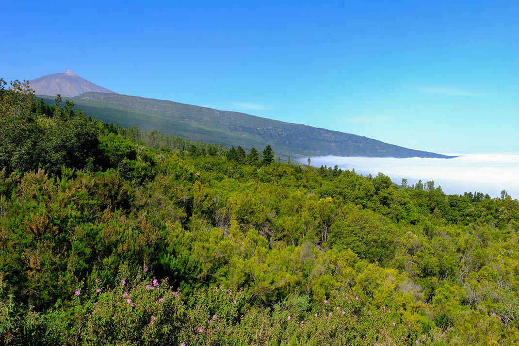
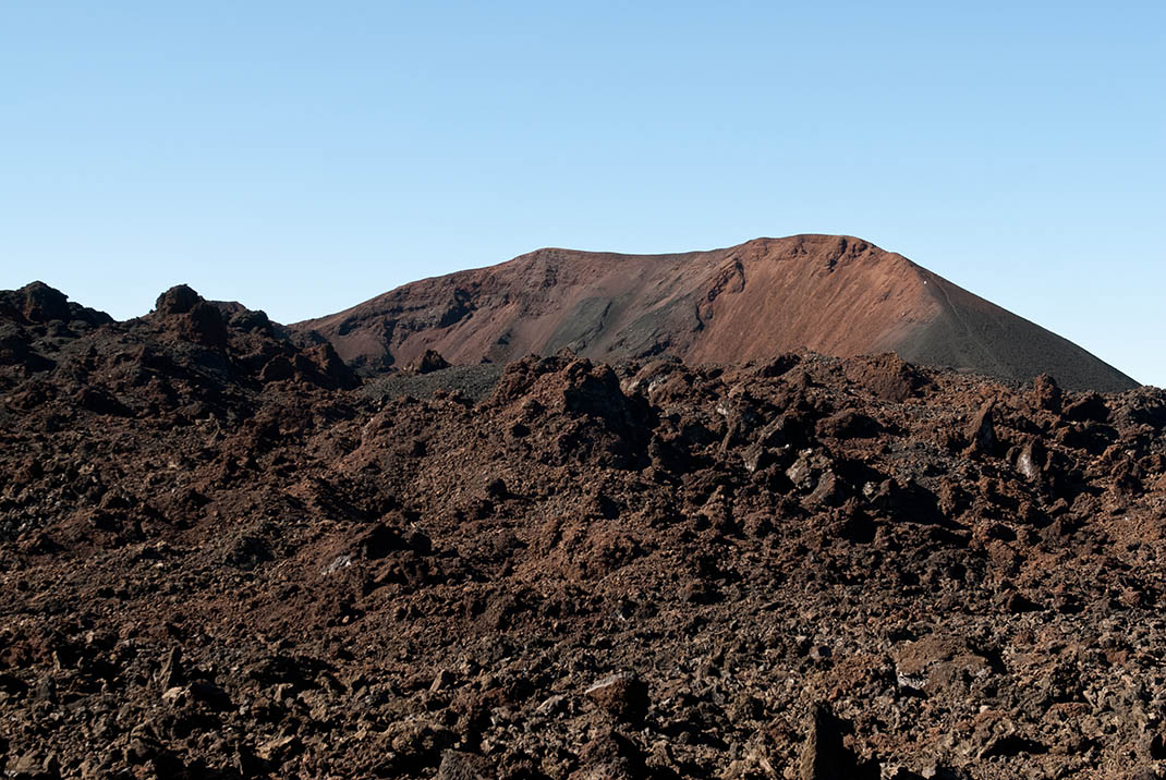
From the viewpoint you will be treated to spectacular views of the south-west coast of the island, a landscape where the intense green of the vegetation contrasts with the red and black of the volcanic soil. On clear days you will even see the outlines of La Gomera and La Palma, adding the finishing touches to the scene.

Leaving the viewpoint behind, the trail gradually enters a typical pine forest of the south of the island, growing denser as you go.

The track then skirts the south-eastern slopes of the Centeno and Los Poleos mountains and finally joins the PR TF 43, where you can extend your route around the famous Chinyero volcano, Tenerife’s youngest volcano, or take the PR TF 43.3 branch heading down to Santiago del Teide, where you can take a bus back to your home or accommodation.

Tips

  • Always stay on the marked trail and do not enter private property, hunting grounds, water galleries, wells or caves.
  • Pay special attention when crossing or walking along trails used by bicycles, horses or motor vehicles and when walking in ravines with water courses.
  • Avoid direct encounters with potentially dangerous animals, such as livestock, beehives, and dogs. 
  • Proceed with caution and watch for obstacles, loose rocks, uneven terrain or steep slopes to avoid accidents and falls.
  • Check out our guide to hiking in Tenerife and, if necessary, contact the emergency services by calling 112.
Recommendations and tips

Guides

No data available

Permits

  • [TEMPORARY MEASURE] Free access without authorisation or reservation for natural or legal entities of a public or private nature, both non-profit (town councils, schools, associations, clubs, etc.) and for-profit (active tourism companies), until 31 December 2024 as established in the Resolution.
  • Free access for all other visitors, no reservation required.
  • Email for enquiries - This email address is being protected from spambots. You need JavaScript enabled to view it.
More information

Technical information sheet

Route information

Walking route

Check your fitness level

Tenerife ON

Linear

1,30 km

0 h 25 m *

  • Altitude gain:53,51 m

  • Altitude loss:19,76 m

  • Maximum altitude:1.470,96 m

  • Minimum altitude:1.437,21 m

Signage

Route code

PR TF 43.6

Posts and signs displaying the PR code and yellow and white marks.

Signage

Route map and profile

Elevation profile

Difficulty

Low *MIDE safe mountain criteria

  • Maximum altitude:1.470,96 m

  • Minimum altitude:1.437,21 m

Connections with other routes

How to get to route start point

Los Poleos Viewpoint, Chío – Boca Tauce road (TF-38), km 15.6.

No public transport service in the area.

Very few parking spaces at the viewpoint.

How to get to route end point

PR TF 43 Garachico – Chinyero, at Pista Montaña de la Cruz.

Accessible only on foot.

Accessible only on foot

Municipalities passed through

  • Santiago del Teide

Protected Areas

Transit

Parque Natural de la Corona Forestal

The Corona Forestal is the largest protected natural area in the Canary Islands, one of the most extensive forests on the islands, the lungs of Tenerife and the gateway to Mount Teide.  As its name ...

Discover the Protected Area
Parque Natural de Corona Forestal

Transit

Reserva Natural Especial del Chinyero

The Chinyero Special Nature Reserve is located on the Abeque ridge, one of the three volcanic rifts on the island and the most active at present. Two historical eruptions have taken place here: ...

Discover the Protected Area
Reserva Natural Especial del Chinyero

Weather

Today, wednesday, in Santiago del Teide


Clear skies
Wind

21 km/h

Temperature

12ºC Maximum

8ºC Minimum

Rain

0%

3 day forecast

thursday

16ºC Maximum

12ºC Minimum

friday

16ºC Maximum

12ºC Minimum

saturday

15ºC Maximum

11ºC Minimum