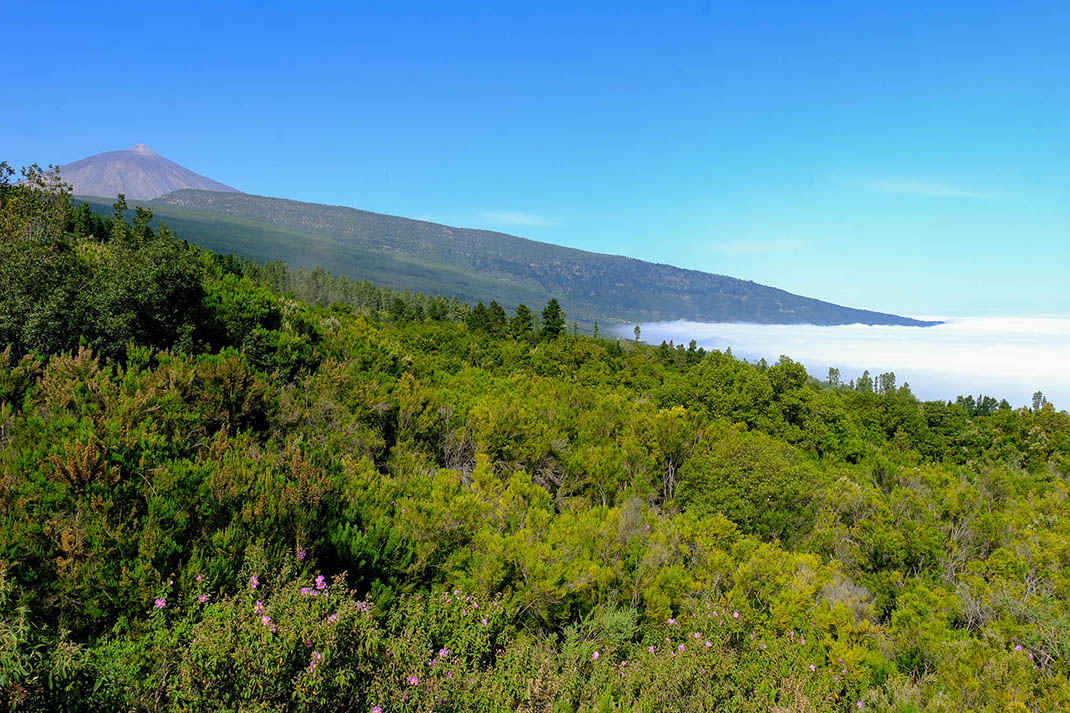
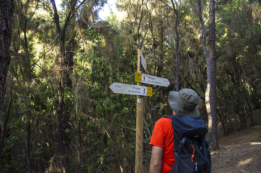
ePrivacy and GPDR Cookie Consent management by TermsFeed Privacy Policy and Consent Generator PR TF 35.3 Llano de Los Corrales - Pinolere

PR TF 35.3 Llano de Los Corrales - Pinolere

PR-TF 35.3

Pinolere

Incident Incident

temporarily closed - Warnings (fire, wind, etc.)

Itinerario cerrado debido al incendio forestal del verano de 2023

Difficulty: Low

Description

Variant of the PR TF 35.1 trail that connects the Mamio forest track with the village of Pinolere by a more westerly alternative route.

Instead of taking the old Camino de Candelaria from Llano de los Corrales, this route descends the ravine named Barranco del Infierno.

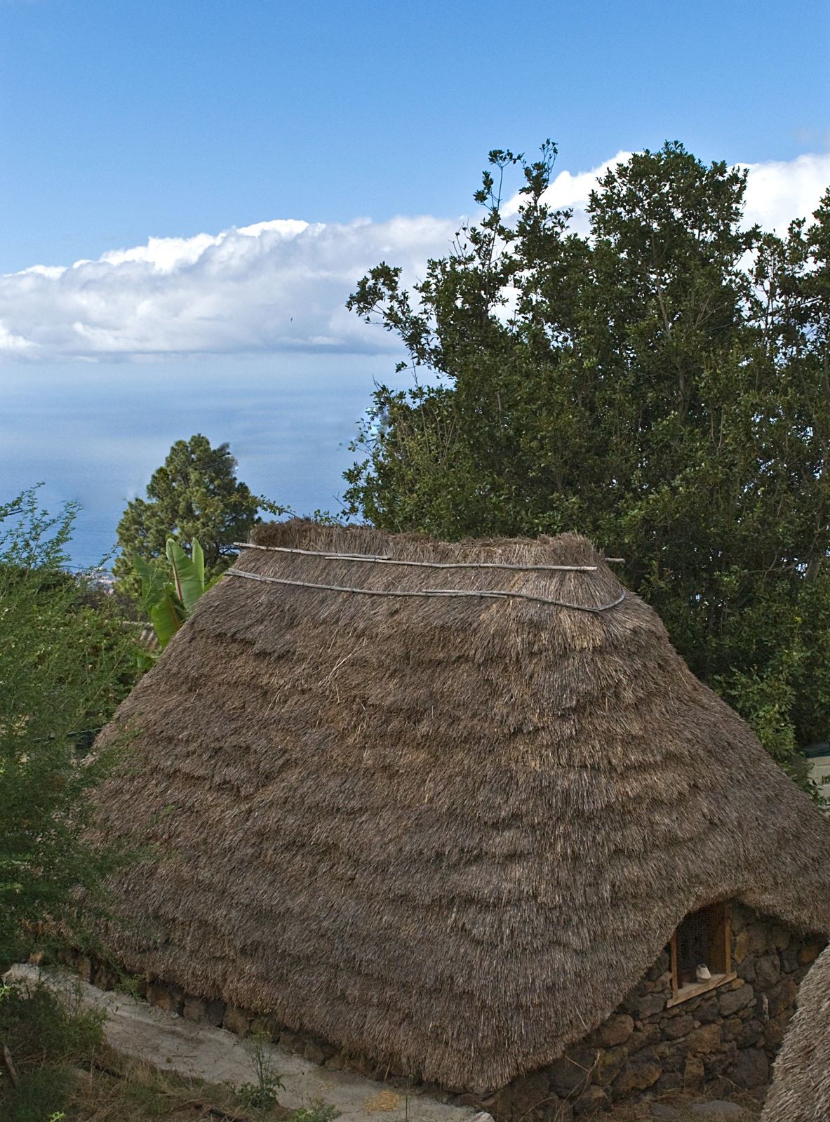
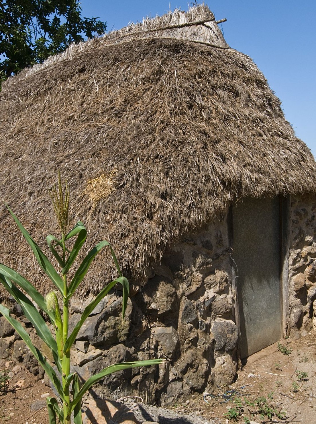
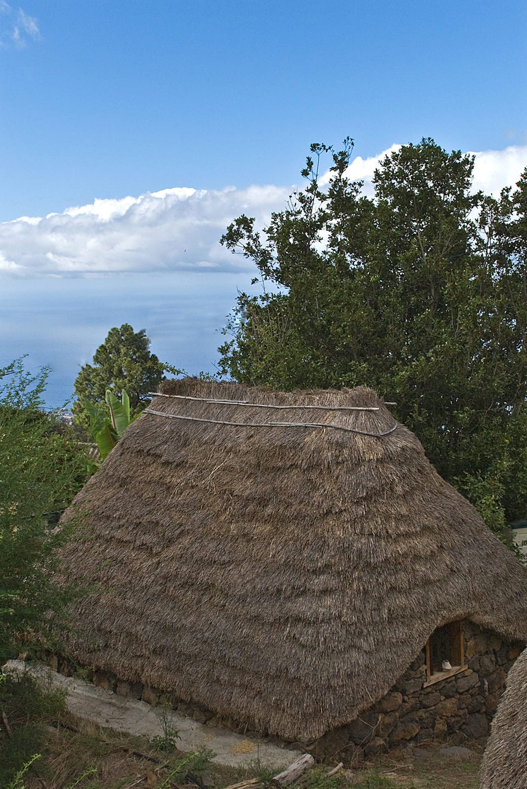
Here you can see traditional thatched huts of La Orotava and various water galleries, before arriving at the Pinolere Church, just a few metres from the Pinolere Museum and Ethnographic Park and its famous huts.

Tips

  • Always stay on the marked trail and do not enter private property, hunting grounds, water galleries, wells or caves.
  • Pay special attention when crossing or walking along trails used by bicycles, horses or motor vehicles and when walking in ravines with water courses.
  • Avoid direct encounters with potentially dangerous animals, such as livestock, beehives, and dogs. 
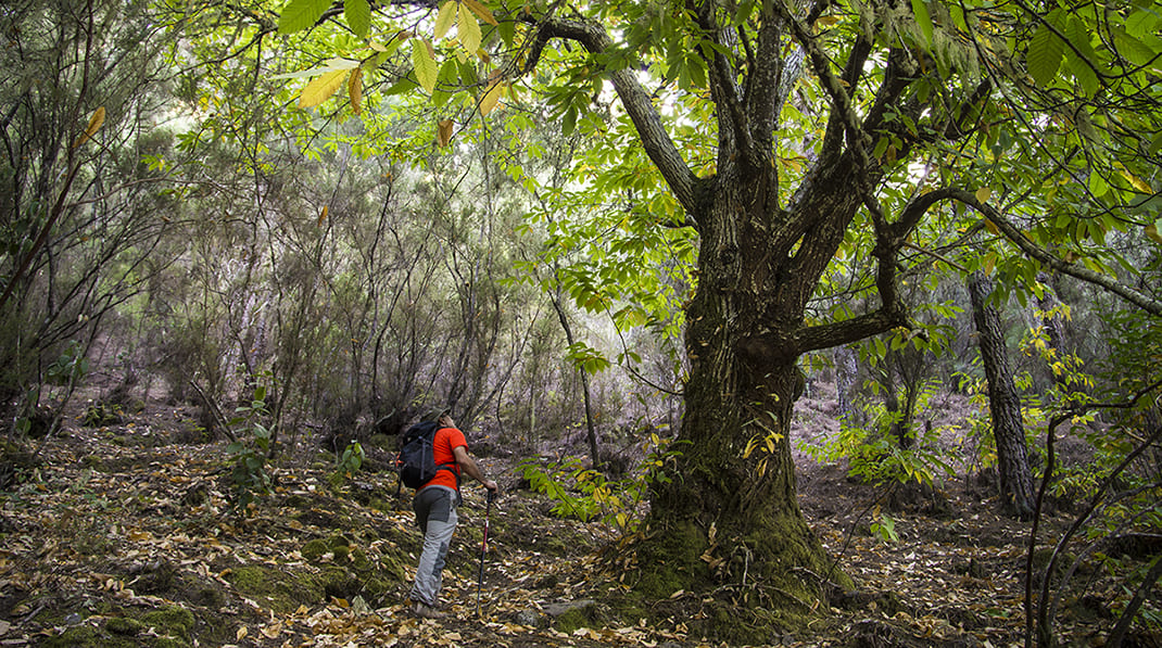
  • Proceed with caution and watch for obstacles, loose rocks, uneven terrain or steep slopes to avoid accidents and falls. 
  • Check out our guide to hiking in Tenerife and, if necessary, contact the emergency services by calling 112.


Recommendations and tips

Guides

No data available

Permits

  • Application form must be submitted by public or private non-profit entities (schools, associations, sports clubs, etc.). Please email This email address is being protected from spambots. You need JavaScript enabled to view it..
  • Authorisation required for public or private for-profit entities, via this link
  • Free access for all other visitors, no reservation required.
More information

Technical information sheet

Route information

Walking route

Tenerife ON

Linear

2,74 km

1 h 20 m *

81,76 m

513,24 m

* TPL_GESPLAN_FITNESS_OBSERVATIONS

  • Altitude gain:81,76 m

  • Altitude loss:513,24 m

  • Maximum altitude:1.186,04 m

  • Minimum altitude:754,56 m

Signage

Route code

PR-TF 35.3

Posts and signs displaying the PR code and yellow and white marks.

Signage

Route map and profile

Elevation profile

Difficulty

Low *MIDE safe mountain criteria

  • Maximum altitude:1.186,04 m

  • Minimum altitude:754,56 m

Connections with other routes

How to get to route start point

Llano de Los Corrales.

Llano de los Corrales only accessible on foot.

Llano de los Corrales only accessible on foot.

How to get to route end point

Pinolere Church, Calle Alzado Los Guanches, 34A.

Bus numbers 345 and 346 (some routes), Ermita Pinolere stop code. TITSA

Parking spaces available in the town.

Municipalities passed through

  • La Orotava

Protected Areas

Transit

Parque Natural de la Corona Forestal

The Corona Forestal is the largest protected natural area in the Canary Islands, one of the most extensive forests on the islands, the lungs of Tenerife and the gateway to Mount Teide.  As its name ...

Discover the Protected Area
Parque Natural de Corona Forestal

Weather

Today, tuesday, in La Orotava


Clouds
Wind

2 km/h

Temperature

16ºC Maximum

13ºC Minimum

Rain

172%

3 day forecast

wednesday

15ºC Maximum

12ºC Minimum

thursday

16ºC Maximum

13ºC Minimum

friday

15ºC Maximum

13ºC Minimum

Places of interest

These are some of the points of interest you can find along this route..

Pinolere
EN Caserío

Pinolere

Pinolere is a small village nestled in verdant woodland with a history shaped by the deep bond of...

Pino_Pista_Organos
EN Árbol monunental

Pine on the Pista de los Órganos trail

This pine tree is home to epiphytes such as lichens (Usnea) and hare’s-foot fern...

Museo_Pinolere
EN Museo

Pinolere Ethnographic Museum and Park

This Ethnographic Museum was inaugurated in 2002 and recreates the popular culture, history and...